Service — on quote
Drone photogrammetry: your building rebuilt in 3D
Hundreds of aerial photos, assembled into a model in relief that you can look at from every angle. A complete, dated record of the site that nobody can obtain from the ground.
What the drone does
Points, then a surface, then reality
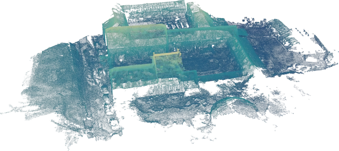
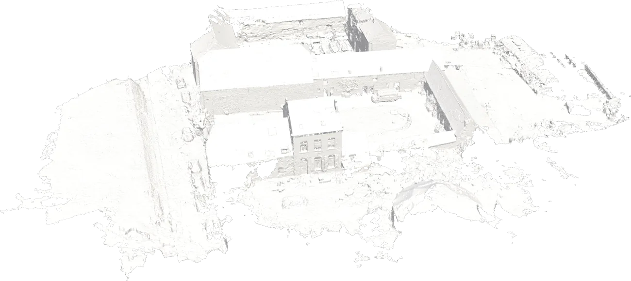
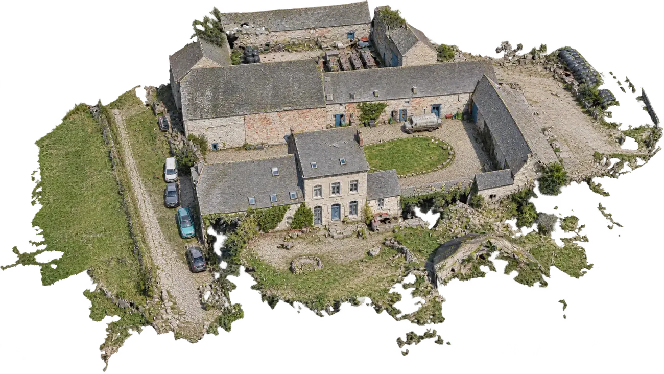
The flight first produces a scatter of points in space, one for every detail recognised on several photos. Those points are joined into a continuous surface, which finally receives the colours of the original photos. Scroll on: it is the same building going through the three stages of the computation.
Scroll on, or take hold of the bar to examine a stage.
The result
An angle the drone never took
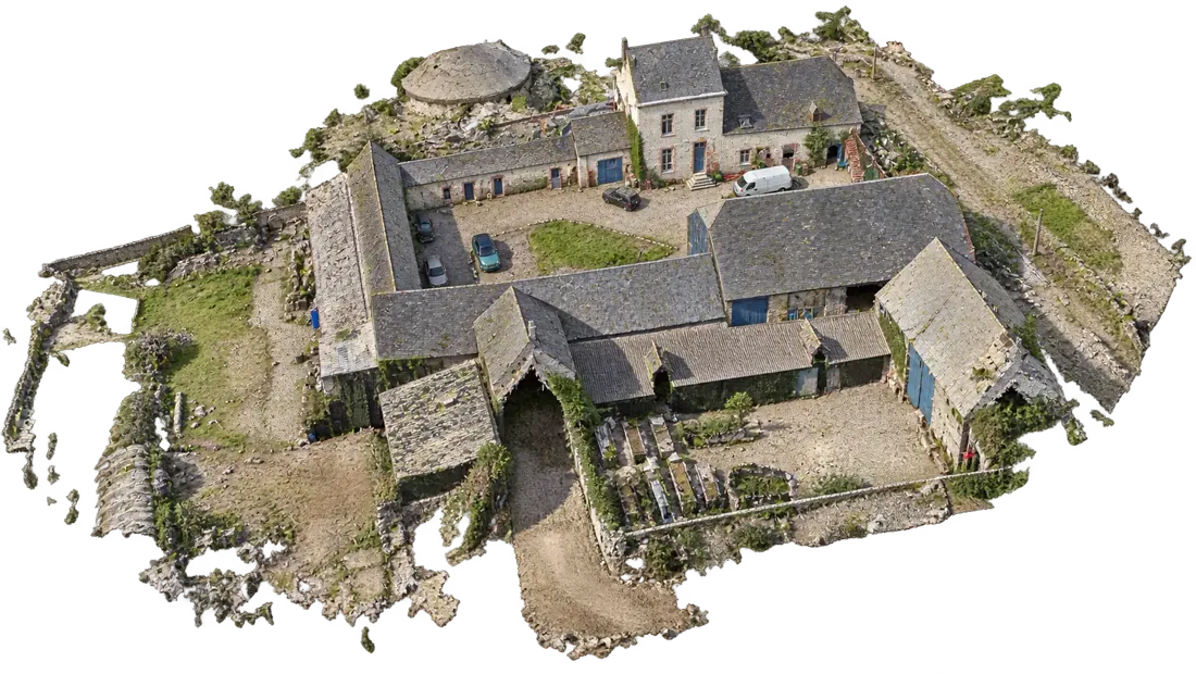
Once the model is rebuilt, the camera goes wherever you want. This view was not photographed: it is computed from the survey. Slates, renderings, vegetation, vehicles: everything that stood there on the day of the flight is there.
Uses
What a 3D model is for
See the whole at once
A farmstead, a condominium, an industrial site: buildings you cannot take in at a glance from the ground. The model shows them whole, from the angle you choose.
Keep a dated record
Before works, before a sale, before damage. The model fixes the state of the building on a precise date and stays consultable years later, without depending on anyone's memory.
Take dimensions
The model is set to scale: ridge lengths, roof surfaces, ground footprint. Enough to price a job without putting up scaffolding.
Give your team a base
Architect, surveyor, roofer, property manager: everyone works on the same support, without travelling and without interpreting scattered photos.
The same model
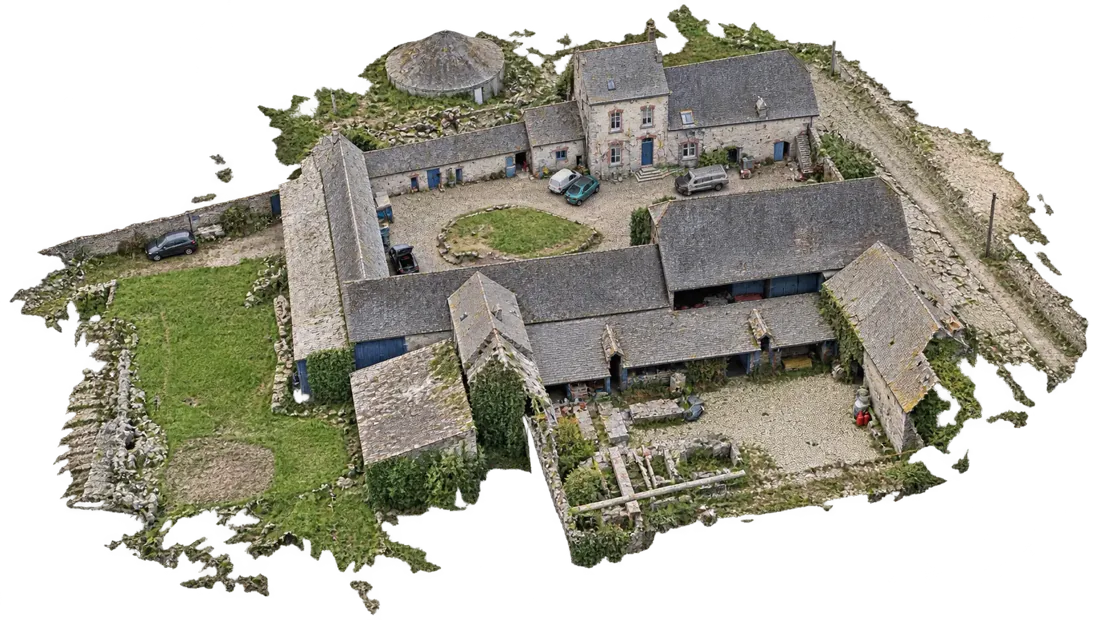
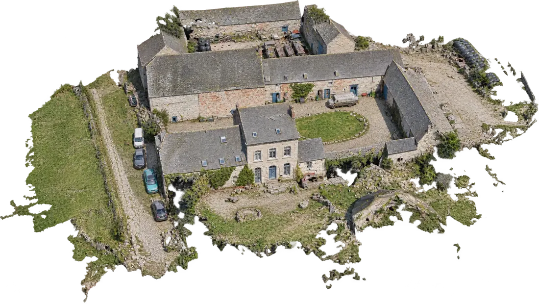
From other angles
None of these viewpoints was photographed as such. They are computed from the model, once it has been rebuilt.
Process
How it works
Scouting
We check the airspace (BCAA / SkeyDrone), the weather and the access points. The flight plan is prepared so that every façade and every roof slope is covered.
The flight
Several passes at different heights and inclinations. The photos overlap widely: that overlap is what makes the relief recoverable.
The computation
The photos are assembled, the point cloud is generated, then the surface and the textures. This is the longest stage: it is counted in hours, sometimes in days.
Delivery
You receive the model and still views from the angles your file needs. The delivery format is agreed with you before the intervention.
Frequently asked questions
Photogrammetry — your questions
What is photogrammetry?
It is the reconstruction of a real object in three dimensions from photographs. The drone flies over the building and takes hundreds of overlapping views. Software then recovers the position of each photo, derives a point cloud from it, and finally a continuous surface dressed in the real colours.
How many photos are needed?
Several hundred for a farmstead or a medium-sized building. Every point of the structure must appear on several photos taken from different positions: that overlap is what makes the relief recoverable.
Can measurements be taken on the model?
The model is set to scale and allows lengths and surfaces to be measured. Accuracy depends on the shooting conditions and on the number of photos; we discuss this with you before the intervention. For a survey that carries liability, those measurements must be validated by a chartered surveyor.
How is this different from a simple aerial photo?
A photo shows a single, fixed viewpoint. A 3D model can be viewed from every angle, including those no drone could hold, and keeps the real proportions of the building. It is a dated record, still consultable years later.
How long does it take to get the model?
The flight lasts from one to a few hours depending on the size of the site. Computing the model, however, is counted in hours and sometimes in days: it is a far longer process than for plain photos. The exact lead time is stated in the quote.
Is the model accurate everywhere?
No, and it matters to know it. Faithfulness depends on how many photos cover each area. What was flown over properly is restored precisely; what the drone only saw from afar, from a single angle or through a tree is filled in approximately by the computation. We point those areas out to you on delivery rather than letting them pass as accurate.
Does this replace a surveyor or an architect?
No. We produce a faithful representation of what stands there, not a certified survey nor an architect's drawing. The model serves as a concrete base on which your surveyor, architect or contractor do their own work.
Scope of our services. The model produced by DronePixel is a representation of what was visible from the air on the day of the flight. It does not constitute a certified survey, a structural expert assessment, an exhaustive technical diagnosis or an architect's or surveyor's assignment. Dimensions drawn from it are indicative; any use that carries liability must be validated by a qualified professional.
Free quote — reply within 48h
A building to survey?
Describe the site and what you intend to do with it. We will tell you what is possible, and at what price, within 48h.