Service — from €350 incl. VAT
Drone construction site monitoring
The progress of your works, documented from the sky at regular intervals. The same angles at every visit, for a reliable comparison from the first dig to handover.
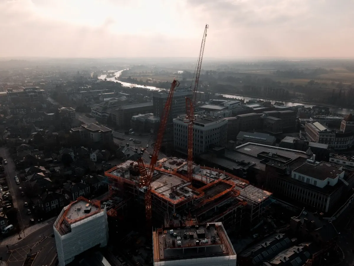
An overview impossible to get from the ground
- Global view of the site — coordination, logistics, storage: everything is visible from above.
- Comparison over time — same positions, same angles at every visit: the evolution is indisputable.
- Efficient communication — client, investors, customers: show the progress instead of describing it.
- Dated documentation — a valuable visual record in case of dispute or questions about execution.
- Final time-lapse possible — assemble the visits into a spectacular before/during/after sequence.
How it works
- Scoping Site size, duration of the works, desired frequency: we define the formula together in the quote.
- Zone check Airspace check and BCAA/SkeyDrone applications if the site is in controlled airspace.
- Regular visits At every visit, same positions and same angles — HD photos and 4K video clips.
- Delivery after each visit Download link organised by date, shareable with all your stakeholders.
What the drone sees
Frequently asked questions
Site monitoring — your questions
How often do you visit the site?
At the rhythm that suits your project: weekly, fortnightly, monthly, or at major milestones (earthworks, structural work, roofing, finishing). The formula is defined together in the quote and can evolve during the project.
Are the photos comparable from one visit to the next?
Yes, that is the core of the service: we take up the same positions and the same angles at every visit. You get a series of perfectly comparable images showing the real evolution of the site over time.
My site is in controlled airspace, is that possible?
In most cases, yes. We check the zone before the quote and handle the necessary applications with the competent authorities (BCAA/SkeyDrone). If a flight proves legally impossible, we tell you before any commitment.
Who receives the images and in what format?
You receive a download link after each visit: high-definition photos and 4K video clips, organised by date. You can share them freely with your client, investors or customers.
Can you make a time-lapse of the whole project?
Yes. With regular monitoring, the images taken from the same angles can be assembled at the end into a striking before/during/after sequence — an excellent communication asset for your company.
Scope of our services. The observations provided by DronePixel are based on elements that are visually observable during the inspection. They do not constitute a structural survey, an exhaustive technical diagnosis or an architect's assignment. Any anomaly requiring further investigation must be examined by a qualified professional.
Free quote — reply within 48h
Your site deserves to be documented
Describe your project and its duration: we'll propose a monitoring formula that fits.